Once sealed off from the world, this forgotten island held more than rusting ruins — one of its volcanoes may have triggered a global climate shift nearly two centuries ago.
A newly released study has linked a massive volcanic eruption on Simushir Island — a remote, once-classified Soviet military outpost — to an unexplained cooling event that swept the globe in 1831. Hidden for decades behind strategic secrecy and geographic isolation, the island’s volcanic chain may have changed global weather patterns more drastically than any eruption since Mount Tambora in 1815.
A Long-Ignored Island With a World-Changing Secret
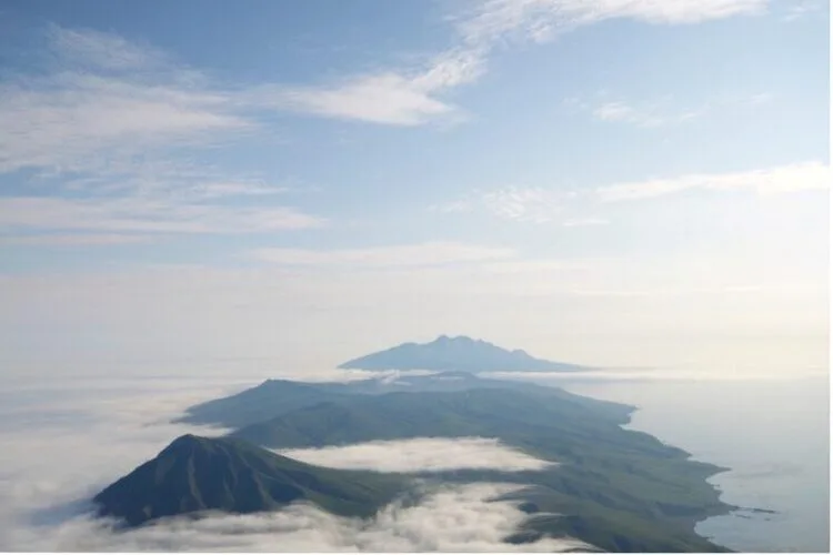
Located in the seismically active Kuril Islands between the Sea of Okhotsk and the Pacific Ocean, Simushir sits along the notorious Pacific “Ring of Fire.” This 8-kilometer-long island was off-limits for much of the 20th century, serving as a covert Soviet nuclear submarine base.
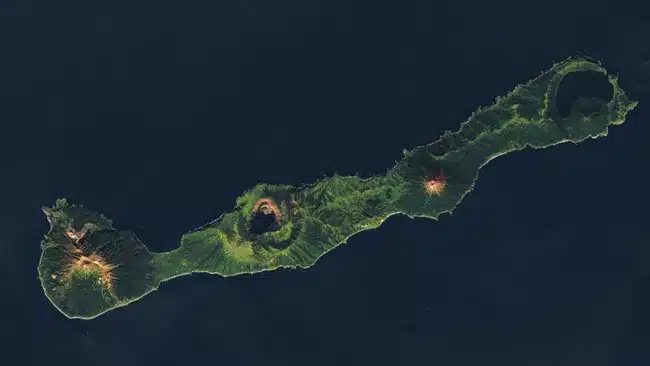
Now deserted, Simushir contains four major volcanoes. Milna, the highest, last erupted in 1914. Prevo followed in 1825. Uratman has remained silent for at least 12,000 years. But it’s Zavaritski, once thought dormant, that may have erupted catastrophically in 1831. A smaller fifth cone, Goriaschaia Sopka, is barely visible in satellite imagery and may be geologically tied to Milna, suggesting a shared magma source.
A Lost Eruption That Shook the Planet
In 1831, the Northern Hemisphere experienced an abrupt temperature drop of about 1°C (1.8°F). Historical records from Europe and North America mention dimmed skies, strange solar behavior, and crop failures — all telltale signs of volcanic interference. Yet no eruption had ever been pinpointed.
That changed in 2024, when scientists at the University of St Andrews matched volcanic ash in polar ice cores to tephra from Zavaritski. Until then, no record existed of an 1831 eruption there.
“We never expected this volcano to be the source,” said volcanologist William Hutchison. “It was entirely off our radar.”
The eruption likely injected massive quantities of sulfur dioxide into the upper atmosphere, forming a reflective aerosol layer that temporarily blocked sunlight and disrupted global temperatures.
A Geological Puzzle of Precision
Adding to the intrigue is the near-perfect alignment of Simushir’s volcanoes — a rare geological feature. Researchers believe magma may be rising through fault lines created by the island’s position on the Kuril-Kamchatka subduction zone, creating the evenly spaced peaks.
This symmetry raises a critical concern: if these volcanoes are geologically linked, one eruption could potentially trigger others — a cascading effect that would magnify their threat.
Worse, the island lies in one of the world’s least-monitored seismic zones. A future eruption could go unnoticed until its consequences reach the rest of the globe.
From Cold War Outpost to Climatological Ground Zero
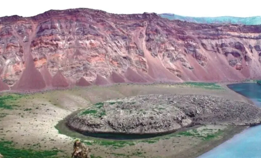
Simushir’s secrets remained locked away during the Cold War. Its natural harbor, Brouton Bay — the remnants of Uratman’s ancient caldera — was a Soviet naval stronghold until 1994. During that era, no scientific research was allowed.
Only after the military’s departure did scientists begin to uncover the island’s story. Using satellite imaging and remote sensing, they’ve since unearthed data that may reshape our understanding of Earth’s climate history — with Zavaritski at the center.
An Island That Could Rewrite the Climate Timeline
Today, Simushir stands as both a relic of military history and a ticking geological enigma. Its forgotten volcanoes are now under new scrutiny, offering clues to a long-misunderstood moment in climate science — and a stark reminder of how much we still don’t know about the hidden forces that shape our world.